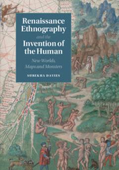
Renaissance Ethnography and the Invention of the Human: New Worlds, Maps and Monsters
Giants, cannibals and other monsters were a regular feature of Renaissance illustrated maps, inhabiting the Americas alongside other indigenous peoples. In a new approach to views of distant peoples, Surekha Davies analyzes this archive alongside prints, costume books and geographical writing. Using sources from Iberia, France, the German lands, the Low Countries, Italy and England, Davies argues that mapmakers and viewers saw these maps as careful syntheses that enabled viewers to compare different peoples. In an age when scholars, missionaries, native peoples and colonial officials debated whether New World inhabitants could – or should – be converted or enslaved, maps were uniquely suited for assessing the impact of environment on bodies and temperaments. Through innovative interdisciplinary methods connecting the European Renaissance to the Atlantic world, Davies uses new sources and questions to explore science as a visual pursuit, revealing how debates about the relationship between humans and monstrous peoples challenged colonial expansion.
{{comment.content}}


 京公网安备 11010802027623号